159 HERRING POND RD
Owner Information
BANIS MICHAEL J &
160 HERRING POND RD
BOURNE, MA 02532-2201


Property Details
159 HERRING POND RD is classified as a Undevelopable Residential Land.
159 HERRING POND RD is valued at $3,300. The land is valued at $3,300 and the structures are valued at $0.
This property is in Zone 2. Confirm with local Zoning Board authorities to ensure there are no overlays or other easements on this property.
The most recent deed for 159 HERRING POND RD is recorded at the local registrar in Book 18542, Page 142. 159 HERRING POND RD was last sold on Monday, May 3, 2004 for $220,000.
Assessment data from fiscal year 2020.
Flood Data
This property is completely within the A Zone (within floodplain).
This information is sourced from the FEMA National Flood Hazard Layer. See our full disclamer.
Broadband Internet Providers
| Provider | Type | Bandwidth (mbps) | |
|---|---|---|---|
| Comcast | Cable | 1000 | 35 |
| T-Mobile | Fixed Wireless | 25 | 3 |
| Viasat Inc | Satellite | 35 | 3 |
| GCI Communication Corp. | Satellite | 0 | 0 |
| Verizon New England Inc. | DSL | 1 | 0 |
| VSAT Systems, LLC. | Satellite | 2 | 1 |
| HughesNet | Satellite | 25 | 3 |
Broadband service provider data from December 2020.
Adjacent Properties
- 155 HERRING POND RD
Undevelopable Residential Land owned by MARTIN JEREMY D - 165 HERRING POND RD
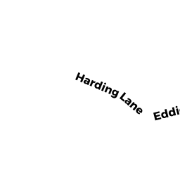
Undevelopable Residential Land owned by PALMER WILLIAM E JR TR OF - 0 HARDING LN
Vacant, Selectmen or City Council (Municipal) owned by TOWN OF BOURNE - 2 HARDING LN
Single Family Residential owned by WENTWORTH LORI L